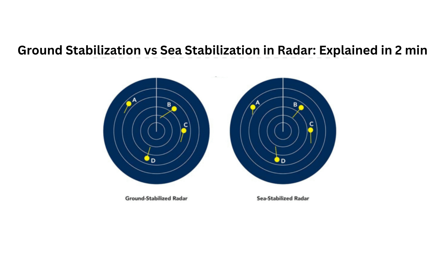
In marine radar systems, stabilization modes determine how radar displays are referenced — either to the ground (seabed) or the sea (water mass). This directly affects how objects appear and how motion is interpreted on the screen.
Let’s break it down step-by-step:
What is Ground Stabilization?
✅ Reference Point:
- The radar takes the seabed (ground) as its reference.
- This means stationary objects like land, ports, or seabed structures appear still on the radar screen.
✅ How It Works:
- It uses data from GPS or Doppler logs to determine the ship’s motion over ground.
- The radar shows the true motion of vessels relative to the ground (Course Over Ground & Speed Over Ground).
✅ When It’s Used:
- Best for navigation in confined waters, rivers, or coastal areas where fixed objects matter (e.g. avoiding rocks, buoys, or shorelines).
Example:
Imagine sailing in a river with a strong current. In ground-stabilized mode, the riverbanks will remain still on the radar, while your ship and others will appear to move over the ground — even if the water is flowing rapidly.
What is Sea Stabilization?
✅ Reference Point:
- The radar uses the water mass as its reference.
- So even fixed land objects like buoys or piers may appear to move with the water current.
✅ How It Works:
- Takes speed from the speed log (which measures speed through water) and course from the gyro compass.
- Displays the motion of all objects relative to the water, not the ground.
✅ When It’s Used:
- Ideal for collision avoidance, especially in open sea.
Helps assess how one ship is moving compared to others through the water.
Example:
If two ships are sailing at the same speed through the water, but one is caught in a strong current, sea-stabilized radar will show the difference in their motion — helping to avoid collisions.
Key Differences at a Glance:
| Feature | Ground Stabilization | Sea Stabilization |
| Reference | Seabed (fixed ground) | Water mass (moving medium) |
| Fixed Objects | Appear stationary | Appear to drift with current |
| Data Source | GPS / Doppler log (Speed & Course over Ground) | Speed log & Gyro compass (Speed through water) |
| Motion Displayed | True motion over ground | True motion through water |
| Best Use Case | Navigating near land / fixed hazards | Avoiding collision with moving vessels |
| Clutter | Clearer near coasts with currents | May appear cluttered in current-heavy areas |
Conclusion
- Use Ground Stabilization when you want to see how vessels move over the earth’s surface — ideal for chart work and avoiding fixed hazards.
- Use Sea Stabilization when you want to track vessel movement through the water — ideal for understanding relative motion and avoiding collisions.
Choosing the right mode depends on the purpose of your navigation — whether you’re near coastal landmarks or maneuvering around other moving vessels in open waters


