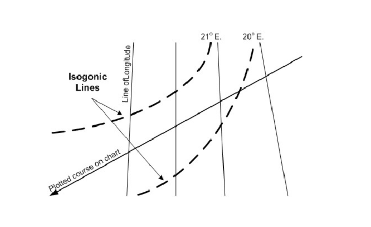
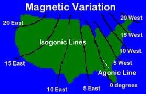
Isogonic lines are imaginary lines on a map that connect points having the same magnetic declination.
In simpler terms, they join places where a compass needle shows the same error or deviation from true north.
🧭 Magnetic Declination is the angle between:
- Magnetic North (where your compass points)
- True North (geographic north on the globe)
If this angle is the same at multiple locations, those spots can be connected using an isogonic line.
Visualize it:
If your compass shows a 5° west error at four different places, drawing a line connecting those four locations gives you an isogonic line for 5° west declination.
Real-World Use of Isogonic Lines
Isogonic lines are essential for navigators, pilots, and mariners because they help:
- Correct compass readings
- Convert magnetic bearings to true bearings
- Ensure accurate course plotting on sea or air navigation charts
🧲 Related Terms You Should Know
1. Agonic Line
A special isogonic line where magnetic declination is zero — meaning magnetic north equals true north.
➡ No compass correction is needed along this line.
2. Isoclinic Line
Lines connecting points with equal magnetic inclination (the angle a magnetic needle dips into the Earth).
3. Isodynamic Line
Lines that connect areas with equal magnetic field strength.
Summary Table
| Term | Meaning |
| Isogonic Line | Connects points with the same magnetic declination |
| Agonic Line | Special case of zero declination (no compass correction needed) |
| Magnetic Declination | Angle difference between magnetic north and true north |
| Use Case | Used in marine charts, aviation maps, military and geodetic surveying |
Why Should You Learn This?
Understanding isogonic lines helps you:
- Read navigational charts accurately
- Avoid navigational errors due to compass deviation
- Build strong fundamentals in magnetic vs true navigation
📌 Pro Tip: Isogonic lines are dynamic. Earth’s magnetic field changes over time, so these lines are updated on new charts every few years.
What is the difference between isogonic and agonic lines?
→ Isogonic lines show equal declination, agonic lines show zero declination.
What is the purpose of isogonic lines on sectional charts?
→ They help navigators adjust compass bearings to true bearings.
What do isogonic lines indicate?
→ The amount and direction of magnetic variation (east or west) from true north.
Whether you’re a marine cadet, pilot, or just curious about how compasses work, isogonic lines are a foundational part of understanding true vs magnetic navigation. They’re invisible on Earth—but vital on your maps.
Stay sharp. Stay on course. And let your compass lead you—but only after you’ve checked the declination!